Ústí nad Labem (Okres Ústí nad Labem)
 |
 |
Ústí nad Labem is divided into four boroughs, which are further divided into 22 administrative parts:
* Ústí nad Labem-město (parts Ústí nad Labem-centrum, Božtěšice, Bukov, Habrovice, Hostovice, Klíše, Předlice, Skorotice, Strážky, Vaňov and Všebořice);
* Ústí nad Labem-Neštěmice (parts Krásné Březno, Mojžíř and Neštěmice);
* Ústí nad Labem-Severní terasa (part Severní Terasa);
* Ústí nad Labem-Střekov (parts Brná, Církvice, Kojetice, Olešnice, Sebuzín, Střekov and Svádov).
Map - Ústí nad Labem (Okres Ústí nad Labem)
Map


Country - Czech_Republic
 |
 |
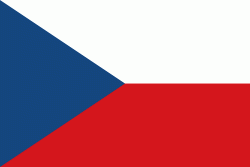
| Flag of the Czech Republic | |
The Duchy of Bohemia was founded in the late 9th century under Great Moravia. It was formally recognized as an Imperial State of the Holy Roman Empire in 1002 and became a kingdom in 1198. Following the Battle of Mohács in 1526, the whole Crown of Bohemia was gradually integrated into the Habsburg monarchy. The Protestant Bohemian Revolt led to the Thirty Years' War. After the Battle of White Mountain, the Habsburgs consolidated their rule. With the dissolution of the Holy Empire in 1806, the Crown lands became part of the Austrian Empire.
Currency / Language
| ISO | Currency | Symbol | Significant figures |
|---|---|---|---|
| CZK | Czech koruna | KÄ | 2 |
| ISO | Language |
|---|---|
| CS | Czech language |
| SK | Slovak language |